Though a straight line appears to be the shortest distance between 2 points, life has a way of confounding geography. Often it is the dalliances and the detours that define us. There are no maps to guide our most important searches; we must rely on hope, chance, intuition and a willingness to be surprised.

Saturday, January 06, 2007

Lake Titicaca (Peru to Bolivia)

Lake Titicaca from a height of about 4,000m. Doesn´t take much of the fab local beer to get tipsy at this altitude.
After the emotional high of Machu Picchu, and a memorable night out clubbing in Cusco, our last destination in Peru, Lake Titicaca, might have been a come down. But, at least in the physical sense, it was anything but. At 3,800m, Lago de Titicaca is half as high again as Machu Picchu and the highest navigable (ie big) lake in the world.

Altitude isnt the only thing about Lake Titicaca that leaves you breathless. At 150 miles long and over 9,000 sq km in surface are, the lake is like a huge water-filled hole in the top of the world, splitting Peru from Bolivia and transforming the weather of the South American high plateau.

The air is so clear on Lake Titicaca that the views are of a different order to anywhere else and photography takes on an unbelievable clarity. And there are some bizarre and unique photo opportunities too.

The Uros Islands definitely fall into the bizarre and unique category. The islands are man-made by a Quechua speaking tribe who were contemporaries of the Incas. Constructed from reeds, the islands can be visited by boat from the mainland, though their exact location can be changed as the islanders can up-anchor and move around the lake, presumably if they take a fancy for a change of scenery.


Many years ago, this fishing and hunting community must have made for a challenging and unusual existence. Now tourism has taken over as the main raison-d¨etre for the communities, though outwardly at least the islands look much the same as they have done for hundreds of years.

The lake plants provide material not just for the construction of the islands, but also for boats and houses. Reeds even constitute part of the local diet.
The lake dominates the border between Peru and Bolivia and all movement between the two.

At one point we have to cross an inlet of the lake. As a first experience of Bolivian infra-structure, the crossing is an eye-opener. Vehicles are punted across the river in ones and twos on pontoons, while bemused travellers cross separately via a fleet of speedboats. The photo shows the Dragoman truck with Dan, our guide and driver, catching 40 winks on the roof.

Our last experience of Lake Titicaca was a mixture of torture (Bolivian water torture) and joy. The crammed speedboat from Copacabana takes two hours to reach Isla del Sol at walking pace, but once there the islands are incredible. It looks every bit like a Greek island but with crystal clear air and waters. And the trek across the island is without doubt one of the best one-day walks I¨ve done.

The communities on Isla del Sol are fascinating. Ali and I stumbled across this town meeting in our trek across the island. We got some strange looks. Of course this was before I became a star of Bolivian tv...

Friday, January 05, 2007

Machu Picchu


The magic of Machu Picchu is in the location - Tikal in Guatemala, for example, is larger, taller and older, while the staggering complexity of the architecture is shared by any number of Incan sites that we had visited in the week before - but what a location.

Perched (never before has the word been so apt) on a mountain top, the whole site looks as if it might at any moment avalanche down either side of the mountain into the valley below. And that´s almost certainly what will happen one day. Even as more and more sections are being uncovered and restored (only 40% of the site is thought to have been discovered to date), a large portion of the middle of the site is being closed off for fear that the footsteps of 3,000 daily visitors are causing the ruins to quite literally split in two across the back of the mountain.

Luckily for us there were far fewer than 3,000 bodies there as Christmas is firmly in the low season for Machu Picchu. And when the low season rains started in the afternoon, the site emptied even further. This was truly a blessing as I got some fantastic photos.

Left - much of the site looks exactly as it would have done when abandoned in the 16th century - only the straw roofs are gone, long rotted away.

Right - even with all the technology available today, we cannot replicate the precision and accuracy of the Inca´s architecture.

The highlight of Machu Picchu for me was climbing Wayna Picchu, the adjacent peak that rises even higher than the ruins themselves. My friend Adrienne and I climbed the very same steps installed by the Incas for the purposes of rituals and sacrifices. Steps made treacherous by the rain which must have put off other visitors, because once at the top we had 30 magical minutes to ourselves in what must be one of the most incredible spots in the world.
The top of the Inca world. A truly unbelievable place.


For many visitors to Machu Picchu, the journey there is as much of an experience as the site, Machu Picchu being the last stop on the classic Inca Trail. Having hitched another route through the Andes (see below), our group took the train to Machu with the posher, non-hiking visitors. And it´s a train journey never to be forgotten - not content with offering us unbelievable views of the Andes through the train´s panoramic windows - Peru Rail´s staff put on a display of traditional dancing, and an alpaca-dominated fashion show, using the aisle of the train as a catwalk.


Wednesday, December 27, 2006

Peru

What to say about the past week? There´s so much I could ramble on about: a 4 day trek through the Andes, altitude sickness at 16,000 feet, visiting extremely poor and remote villages in the mountains, Christmas Day (with mulled wine) in a tent, one of the greatest (and weirdest) train journeys in the world and an incredible day at Machu Picchu.

I don’t have much time to update the website before I have to leave for Bolivia, so once again, ill just let the pictures do the talking. Here´s a few photos from the first couple of days.

Cusco and Around
Hadn´t done much travel planning beyond Belize - I thought Cusco was a small town, not a city of 500,000 people – doh. (Wearing my BCVI t-shirt in this pic!)

Cusco is truly built for taking photographs. The weather has been pretty mixed and it took me a while to adjust to the altitude of 3300m.

After a couple of days on my own in Cusco. I met up with the Dragoman group that I´ll be touring around Peru, Bolivia and Chile with for the next month. There are seven of us at the moment, though we´re losing a couple of people in the next few days.

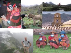
The first part of the tour was a four-day trek of the Lares Valley in the Andes. This was a little different to the typical Inca Trek as we were also visiting remote Andean farming communities with traditions dating back to the time of the Incas.

Our first stop was in Quisharani, a village of a couple of hundred people at a height of 3,850 metres. We were dropped off by our bus with all our possessions for the next 3 days in the wilderness. After two days in Cusco I´d gotten over the tiredness, loss of apetite (no really!) and breathlessness at 3,300 metres, but this was higher still. A restless night under an incredibly clear, star-filled sky followed. But in the morning, the views were spectacular.


From Quisharani to Cuncan

The first night at altitude was bad. And we had barely started the trek the next morning when the effects of altitude on the body became clear. By the time we reached the peak for that day at 4,500 metres, one of our group of seven had spent most of the day on the emergency donkey and two of the others were struggling badly.

I had a pounding headache for a few hours, but the fantastic scenery was incentive enough to keep going. Only four of us survived to walk on the next day and I would have been more than disappointed not to be one of them.

Our second camp was at the village of Cuncan at 3,800m. As in the previous village we were welcomed by the locals, though neither we nor they seemed exactly clear on what our respective roles were. The intention of the alternative route is to give a more rewarding experience to the traveller by taking them away from the busy classic trail and giving them exposure to more remote and poorer local communities. Also, both through having the opportunity to sell souvenirs to travellers and through the fraction of the trip cost that goes towards the funding of education and other services, two of the poorest communities in the Andes can at least receive some benefit from the huge cash-cow that is tourism in the Peruvian Andes.
A highly competitive game of football in Cuncan, the second village we visited.

In practise, I found that there wasnt a lot of interaction between ourselves and the commnities. We were warmly welcomed, and the locals were very friendly and keen to sell us local handicrafts. However, we didn’t really have any structured interaction with the locals beyond an impromptu football game and giving out hot chocolate and buns.
As it was Christmas, we gave out hot chocolate and buns to the locals. This was obviously a real treat for children and adults alike.

I would like to have seen more about how activities in the community worked , for example the local school, which was being funded partly through the money we paid for the trip. Though the fact that the school had closed for Chistmas was a bit of an impediment.

Throughout our trip we were catered for by a group of five porters and two chefs. We also had our very experienced and knowledgable guide ‘Smithy’ - far left in this picture, next to Adrienne, Ali, Diana and Clint.


From Cancun to the Sacred Valley


Activity in the communities ends shortly after nightfall, or in our case, a short while after dishing out the chocolate and buns. The next morning, our reduced group set out for the longest day – a nine hour hike up to 4,800m. The following photographs don’t quite capture how incredible the views were and how tough the climb was.

Christmas Day was also the final day of the trek and we had a beautiful four hour walk down into the Sacred Valley, from where we would catch the train to Machu Picchu the next morning.


Overall, though i thought the tour could be improved a bit, I was really impressed with the experience, and in particular with the work that Dragoman and Andina travel are doing in the villages. As I mentioned back in August, I intend to use some of the money I raised through sponsorship to help local causes that I see on my travels. I gave 200 US dollars to Andina travel as a donation to the villages of Quisharani and Cuncan. Thanks again for your donations and I will post details of how the money has been used. Ta.


Our camp on Christmas Eve was in an incredibly remote and beautiful location. What a place to wake up on Christmas morning.


Saturday, December 16, 2006

With a Tear in My Eye…

Being a ‘glass-half-full’ kinda guy, I’m loathe to make this anything other than a cheery farewell to Belize. But leaving was hard! As a guy who watches It’s a Wonderful Life at this time of year (every year) and always ends up sobbing (poor little Zuzu’s petals!!), I have to say it was… emotional.

On the other hand, I’d like to look at it this way: the reason it was so difficult to leave is because everything has worked out so well for me here. I’ve been very fortunate. In particular, the project has been really rewarding for me (and should hopefully be of great value to BCVI), discovering Belize has been a joy, and I’ve made some great friends.

The Project has gone really well


“Do I really have to read this thing? It’s painful just picking it up.” I hand over my 22,000-word report to BCVI Director, Mrs Joan Musa.

Between June and August of this year, I walked 500 miles around Scotland (and London), raising over £3,000 of funding towards a Challenges WorldWide organised project with the Belize Council for the Visually Impaired. Now that the project is completed, what did all that fundraising achieve? Was it worth it?

When I arrived on the 7th of September my goal was to “develop a financial plan incorporating forecasts and financial planning advice to ensure financial sustainability for BCVI.”

Over the following three months, I carried out research into the eye-care sector in Belize, interviewed BCVI staff, and developed a financial model based on BCVI’s accounting system. The key outputs were (1) a 65-page report setting out all my findings, providing financial forecasts for BCVI to 2010 and setting out 9 key recommendations to help ensure future financial sustainability and; (2) a spreadsheet-based model, which BCVI staff will be able to use in future to carry out their own financial modelling.

The feedback I’ve had so far has been very positive – in the short term, BCVI’s director plans to share the report with BCVI’s key funders in advance of discussions about BCVI’s future funding. In the longer term, I hope some of the recommendations I’ve made will be adopted and will help strengthen BCVI’s finances. This will help BCVI extend their lifeline services to an even greater share of Belize’s poor population.

LEFT: Dana, Vic, Joan Samuels, Lisa, Joan Musa and Kaiser Sose

RIGHT: Dana takes Christa’s place behind the camera. Hi to Naomi and Mark who weren’t in on my last day.

Hope this reassures everyone who made a donation that the money was well spent, especially those of you who were beginning to suspect that your donations had gone into a slush fund to finance deep-sea diving, rampant consumption of rum/belikin, and the bribing of border guards.


What it’s all about. BCVI and CARE at work

Travelling in Belize has been superb

And I managed to get to Mexico, Guatemala and Honduras as well.

Mexico

Guatemala
Honduras…

…And Belize


And lastly (new) Friends and Family

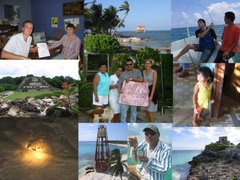
It was a real stroke of luck to stay with Evan and Mari. They fed me, entertained me and looked after me, and put up with my dodgy Spanish for three months - above and beyond the call of duty. I am extremely grateful.


I’ve made some great friends here. Hope it all goes well for Karin back in Sweden, Kirsty - who’s done a great job cataloguing the history of the Red Cross here and has made a superb documentary about it – and Dorothy, who’ll be here for almost another two years with Peace Corps.

And I will especially miss my long-suffering (at least as long as I was driving) travelling companion Teri.

Maybe the 3 months have passed pretty quickly, but it honestly feels more like I’ve been here for a year. I’ve really enjoyed life in Belize – if I win the lottery I’m coming back to do this permanently. But for now I have to move on.

Next stop deepest, darkest Peru. I’ll be out of email contact whilst in the mountains so I just want to say have a fab Christmas and New Year. Please keep in touch and I’ll be back online soon.

Merry Xmas from Teri and I to one and all.


Sun sets on Belize

Son of a Gun Gonna Have Big fun, erm… in Cayo

A brief break in the rain at Cahal Pech

For my last trip in Belize I went back to Belize’s adventure capital San Ignacio (aka Cayo). Planned to relax (and catch up on sleep) after the hectic last week when I’d been working all hours to finish the project and the report.


These lizards in Cayo are recovering well from near extinction, now that hunting and eating them are outlawed. They can be well over 6 feet long, tail included.

The last week has been the wettest of the year in Belize. The rainy season is supposed to be over, but the flooding in San Ignacio suggests otherwise. This footbridge is a key link between local villages and San Ignacio itself. It is usually well clear of the water.


The main road into San Ignacio is a few feet under the flood waters here. Fortunately, one other bridge links San Ignacio with the rest of Belize. And even on Thursday morning that was high above the flood waters.


Most of Cayo’s adventure trips were washed out by the weather. I was quite happy to just chill out instead. Still managed to squeeze in one more Mayan site – the oldest inhabited site in Belize, Cahal Pech.


Cahal Pech