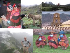
Lake Titicaca from a height of about 4,000m. Doesn´t take much of the fab local beer to get tipsy at this altitude.
After the emotional high of Machu Picchu, and a memorable night out clubbing in Cusco, our last destination in Peru, Lake Titicaca, might have been a come down. But, at least in the physical sense, it was anything but. At 3,800m, Lago de Titicaca is half as high again as Machu Picchu and the highest navigable (ie big) lake in the world.
 The air is so clear on Lake Titicaca that the views are of a different order to anywhere else and photography takes on an unbelievable clarity. And there are some bizarre and unique photo opportunities too.
 The Uros Islands definitely fall into the
  bizarre and unique category. The islands are man-made by a Quechua speaking tribe who were contemporaries of the Incas. Constructed from reeds, the islands can be visited by boat from the mainland, though their exact location can be changed as the islanders can up-anchor and move around the lake, presumably if they take a fancy for a change of scenery.

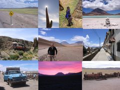
 At one point we have to cross an inlet of the lake. As a first experience of Bolivian infra-structure, the crossing is an eye-opener. Vehicles are punted across the river in ones and twos on pontoons, while bemused travellers cross separately via a fleet of speedboats. The photo shows the Dragoman truck with Dan, our guide and driver, catching 40 winks on the roof.
 The communities on Isla del Sol are fascinating. Ali and I stumbled across this town meeting in our trek across the island. We got some strange looks. Of course this was before I became a star of Bolivian tv...
Altitude isnt the only thing about Lake Titicaca that leaves you breathless. At 150 miles long and over 9,000 sq km in surface are, the lake is like a huge water-filled hole in the top of the world, splitting Peru from Bolivia and transforming the weather of the South American high plateau.
The air is so clear on Lake Titicaca that the views are of a different order to anywhere else and photography takes on an unbelievable clarity. And there are some bizarre and unique photo opportunities too. The Uros Islands definitely fall into the
  bizarre and unique category. The islands are man-made by a Quechua speaking tribe who were contemporaries of the Incas. Constructed from reeds, the islands can be visited by boat from the mainland, though their exact location can be changed as the islanders can up-anchor and move around the lake, presumably if they take a fancy for a change of scenery.
 Many years ago, this fishing and hunting community must have made for a challenging and unusual existence. Now tourism has taken over as the main raison-d¨etre for the communities, though outwardly at least the islands look much the same as they have done for hundreds of years.
The lake plants provide material not just for the construction of the islands, but also for boats and houses. Reeds even constitute part of the local diet.
The lake dominates the border between Peru and Bolivia and all movement between the two.
At one point we have to cross an inlet of the lake. As a first experience of Bolivian infra-structure, the crossing is an eye-opener. Vehicles are punted across the river in ones and twos on pontoons, while bemused travellers cross separately via a fleet of speedboats. The photo shows the Dragoman truck with Dan, our guide and driver, catching 40 winks on the roof.Our last experience of Lake Titicaca was a mixture of torture (Bolivian water torture) and joy. The crammed speedboat from Copacabana takes two hours to reach Isla del Sol at walking pace, but once there the islands are incredible. It looks every bit like a Greek island but with crystal clear air and waters. And the trek across the island is without doubt one of the best one-day walks I¨ve done.
The communities on Isla del Sol are fascinating. Ali and I stumbled across this town meeting in our trek across the island. We got some strange looks. Of course this was before I became a star of Bolivian tv...